
Webinar
Mesic Prioritization at Trout Creek Ranch:
Tools for prioritizing mesic restoration across large landscapes
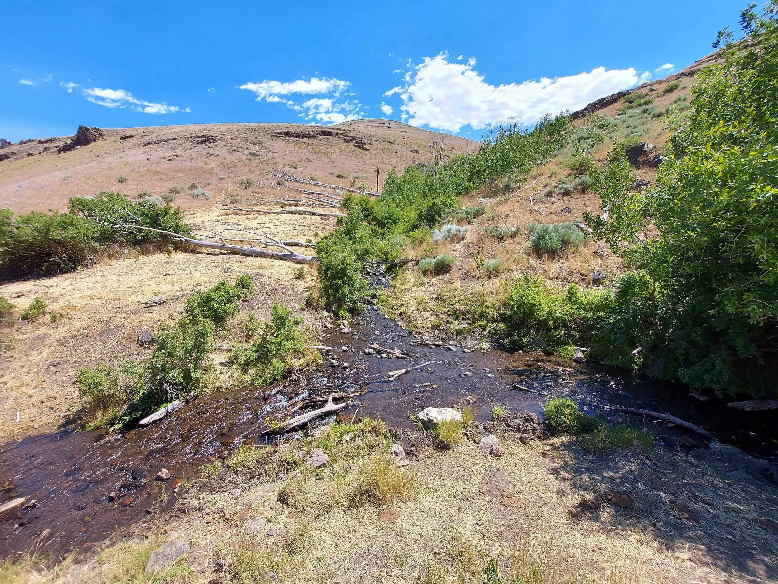
This SageCon-hosted webinar in April 2024 provided short and informative presentations on selected decision support tools for riparian restoration at multiple scales. The webinar centered a case study at Trout Creek Ranch in Fields, OR where The Nature Conservancy and Oregon Desert Land Trust combined remote sensing products, field assessments and local knowledge to prioritize restoration and management action across 500,000 acres of rangeland. See the link to the recording and additional resources, including a workflow to replicate the process conducted at Trout Creek Ranch in your landscape.
Hosted April 15th 2024
Oregon Desert Land Trust & Trout Creek Ranch
Presenter slides
Trout Creek Ranch Case Study - Jessie Griffen
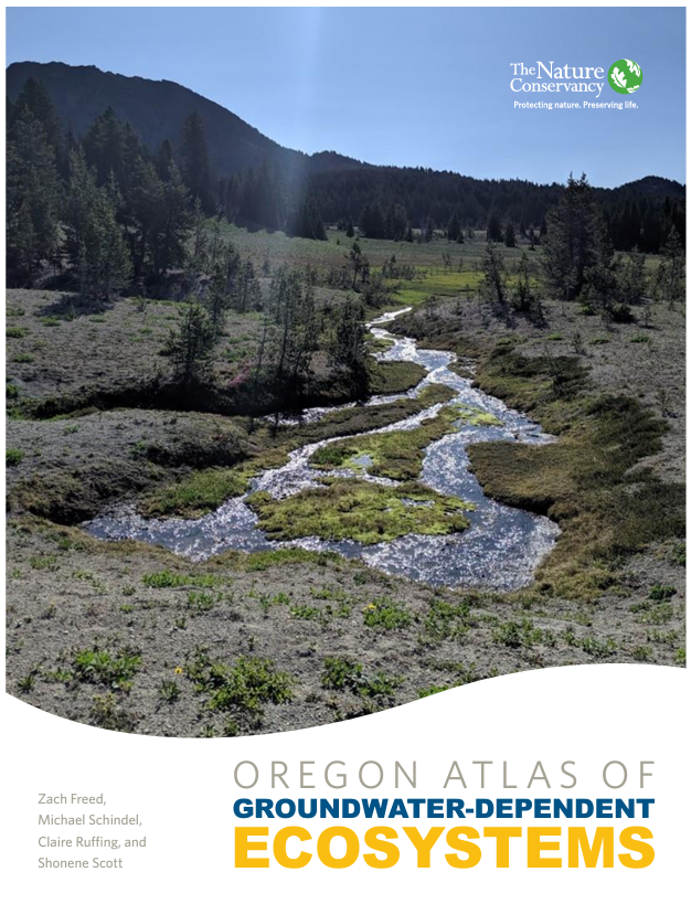
Groundwater Dependent Ecosystems Atlas - Zach Freed
Climate Engine - Kristen O’Shea
Want to learn more about about how to approach prioritizing mesic work in your landscape?
Use our step-by-step workflow combining remotely sensed data layers and field-based assessment for prioritizing mesic and riparian areas in rangelands.
Tools featured in the SageCon mesic webinar or used at Trout Creek Ranch
Groundwater Dependent Ecosystems (GDE) Atlas
Groundwater-dependent ecosystems (GDEs) are springs, rivers, wetlands, and lakes that rely on groundwater for their structure, composition, or function. Often the only perennial source of water in semi-arid or arid regions, these ecosystems are disproportionately biodiverse relative to their surroundings and are characterized by their resilience to short and long-term climate variation. GDE Streams and Springs have been mapped in Oregon and are available on the SageCon Landscape Planning Tool (under the Water folder).
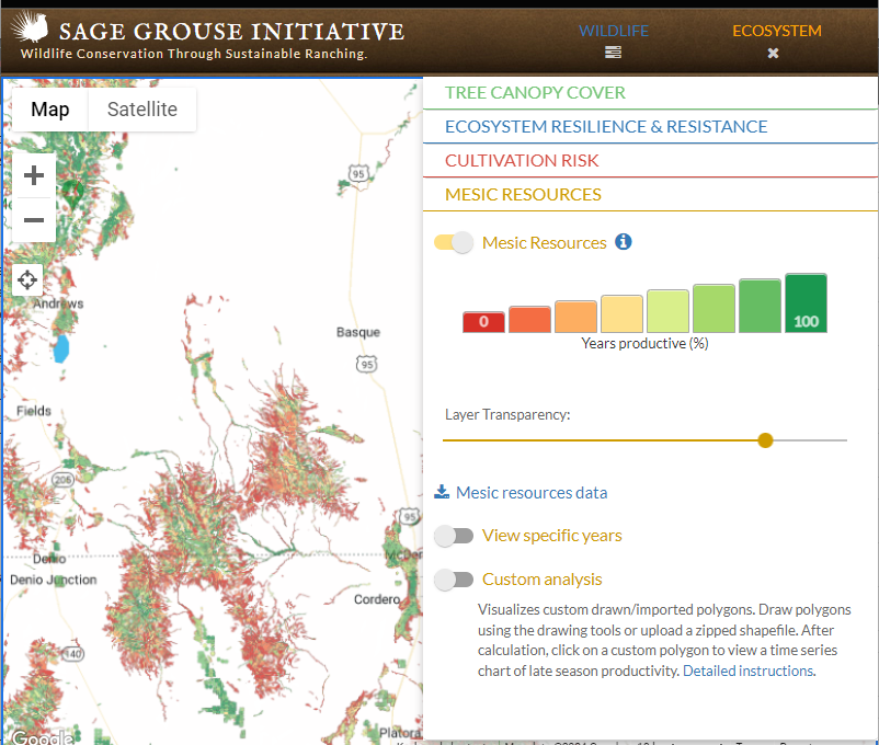
Sage Grouse Initiative Mesic Resources Map
This mesic layer uses normalized difference vegetation indices (NDVI), which quantify photosynthetic activity and correlate closely to fluctuations in net primary productivity, to depict the estimated extent and availability of mesic resources through time (1984-2016) across the entire range of sage grouse. A similar but finer-scale and more up-to-date map of late-season mesic productivity for eastern Oregon has been added to the SageCon Landscape Planning Tool - see Climate Engine, below.
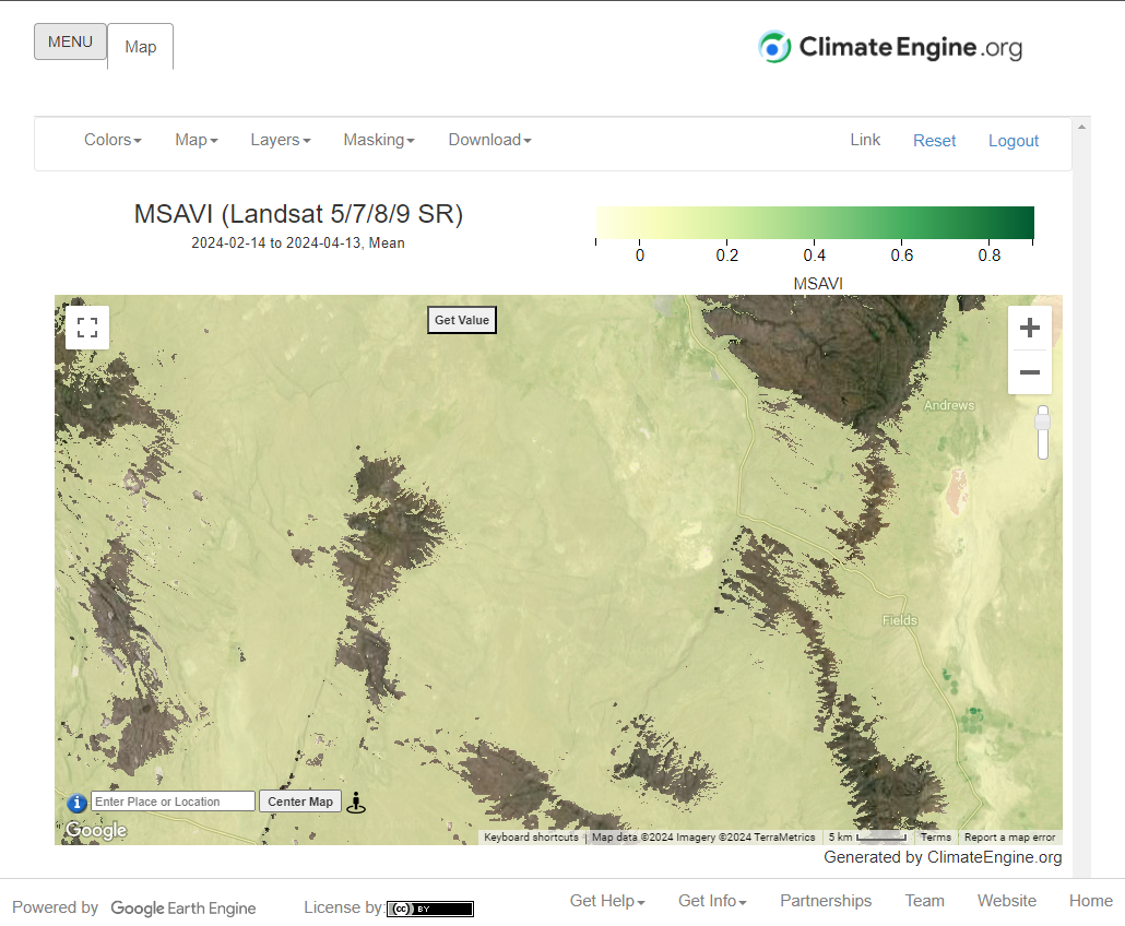
Climate Engine
A robust suite of remote sensing products including climate information, drought forecasts, and rangeland vegetation datasets that allow users to assess and monitor landscape change with the most up to date satellite information hosted by Google Earth Engine cloud computing. Expanding upon the capabilities of the SGI Mesic Resources Map, Climate Engine can be used to not only assess where mesic resources are on the landscape using NDVI with near real time data, but also monitor restoration effectiveness by comparing NDVI trends over time to climatic variables like precipitation and temperature to determine whether the change you are seeing on the landscape is a result of management action or climate variation (check out this example video). Thanks to the team at Climate Engine, a late-season mesic productivity map is now available for eastern Oregon through the SageCon Landscape Planning Tool (under the Water folder).
Other tools and resources for mesic planning
Assessment Methods
Threat-Based Management for Creeks, Streams and Rivers
This tool is designed to rapidly assess conditions for perennial and intermittent lotic (flowing) systems and support decisions related to management of these mesic resources. It helps managers understand the basics of riparian function, determine whether a riparian area is functioning properly, and how to restore or maintain proper function.This tool complements more time-intensive methods such as PFC by providing an initial evaluation of existing conditions in plain language, an assessment of stream resilience, and a framework for assessing and prioritizing management needs.
Proper Functioning Condition (PFC) Assessment
PFC is a standardized assessment protocol for assessing the physical functioning of perennial or intermittent lotic/lentic riparian systems, including a PFC Assessment for Lotic Areas and a PFC Assessment for Lentic Areas.
Springs Inventory Protocol (SIP)
SIP Level One is a rapid protocol that can be used to systematically verify reported springs locations, record newly discovered springs, record instances of reported springs that are dry or mismapped, and collect basic descriptive observations of condition and anthropogenic alterations. The SIP Level Two is a more detailed assessment of ecological integrity of springs, and documents an array of variables related to site geography and geomorphology, biota, flow, and other conditions.
Other Mesic Resources
An international consortium of researchers, software developers, and practitioners build tools and pioneer solutions to better understand, simulate & manage our riverscapes. In addition to hosting a ton of useful data and tools, the Riverscapes Consortium also supports a community of practice for mesic management and restoration solutions. BLM recently ran the BRAT and RCAT tools in southeastern Oregon, accessible via a web viewer (Note - you will need to create a free login).
Beaver Restoration Assessment Tool (BRAT) - BRAT is a planning tool intended to help researchers, restoration practitioners and resource managers assess the potential for beaver as a stream conservation and restoration agent over large regions and watersheds.
Riparian Condition Assessment Toolbox (RCAT) - A suite of stream network assessment tools designed to delineate valley bottoms, assess riparian vegetation, evaluate floodplain condition and estimate recovery potential of riparian areas.
Utah State University Process-Based Restoration homepage - a definitive resource for low-tech process-based restoration in streams.
Zeedyk resources home page - a compilation of resources for wet meadow restoration using rock or Zeedyk structures.
Field Guide for the Identification and Use of Common Riparian Woody Plants of the Intermountain West and Pacific Northwest Regions (NRCS 2008) - guide to identification and collection of native riparian plant materials for restoration.
The Western Beavers Cooperative has many resources including a 2024 Willow Workshop, which provides a detailed how-to webinar for planting riparian plants preferred by beavers including willows, and lots of additional riparian shrub and tree related resources.
Resources for grazing management in mesic areas
● Rangeland Water Developments at Springs: Best Practices for Design, Rehabilitation, and Restoration (Gurrieri, 2020) - guidance on spring development designs and retrofits that balance the needs of livestock with spring ecosystems.
● Grazing Management Processes and Strategies for Riparian-Wetland Areas. 2006. Technical Reference 1737-20. BLM/ST/ST-06/002+1737. Bureau of Land Management, National Science and Technology Center, Denver, CO. 105 pp.
● Swanson, S. R., Wyman, S., & Evans, C. (2015). Practical Grazing Management to Meet Riparian Objectives. Journal of Rangeland Applications, 2, 1-28.