
Oregon Rangeland Monitoring Program
Over the last decade, significant work has been done with herbicide treatments to address annual grass and broadleaf weeds, and juniper removal in the name of wildfire resiliency and sage-grouse habitat enhancement. Two notable projects include OWEB’s Baker Sage Grouse FIP and Senate Bill 762’s Southeast Oregon Wildfire Resiliency (SOWR)project, which cumulatively invested 20 million in state funding and leveraged an additional $20 million in federal funding to address these threats on a massive scale. A portion of this investment is being used to assess how well the actions are working by monitoring the treatments through a protocol called the Oregon Rangeland Monitoring Program (ORMP). ORMP was initiated in 2022 with input from USFWS and UGGS as the Baker Local Implementation Team sought a monitoring approach that would produce robust data to help understand outcomes at 306 treatment locations.
Data collected from these two major projects is building a dataset that will provide insight into restoration effectiveness across the sagebrush ecosystems of Oregon and is growing to include additional projects in other locations, including ODFW wildlife areas and Department of State Lands. Currently, 496,912 acres of treatments are being monitored on private and public land in nine Eastern Oregon counties. Monitoring points are generated by USGS based on variations in aspect, elevation, slope, and other ecological factors across the treatment area and nearby control plots. The highly detailed protocol assesses the site using photopoints, evaluation of cover and soil erosion, a vegetation inventory with an optional line-point intercept survey, and an ecostate assessment that helps calibrate the statewide ecostate models.
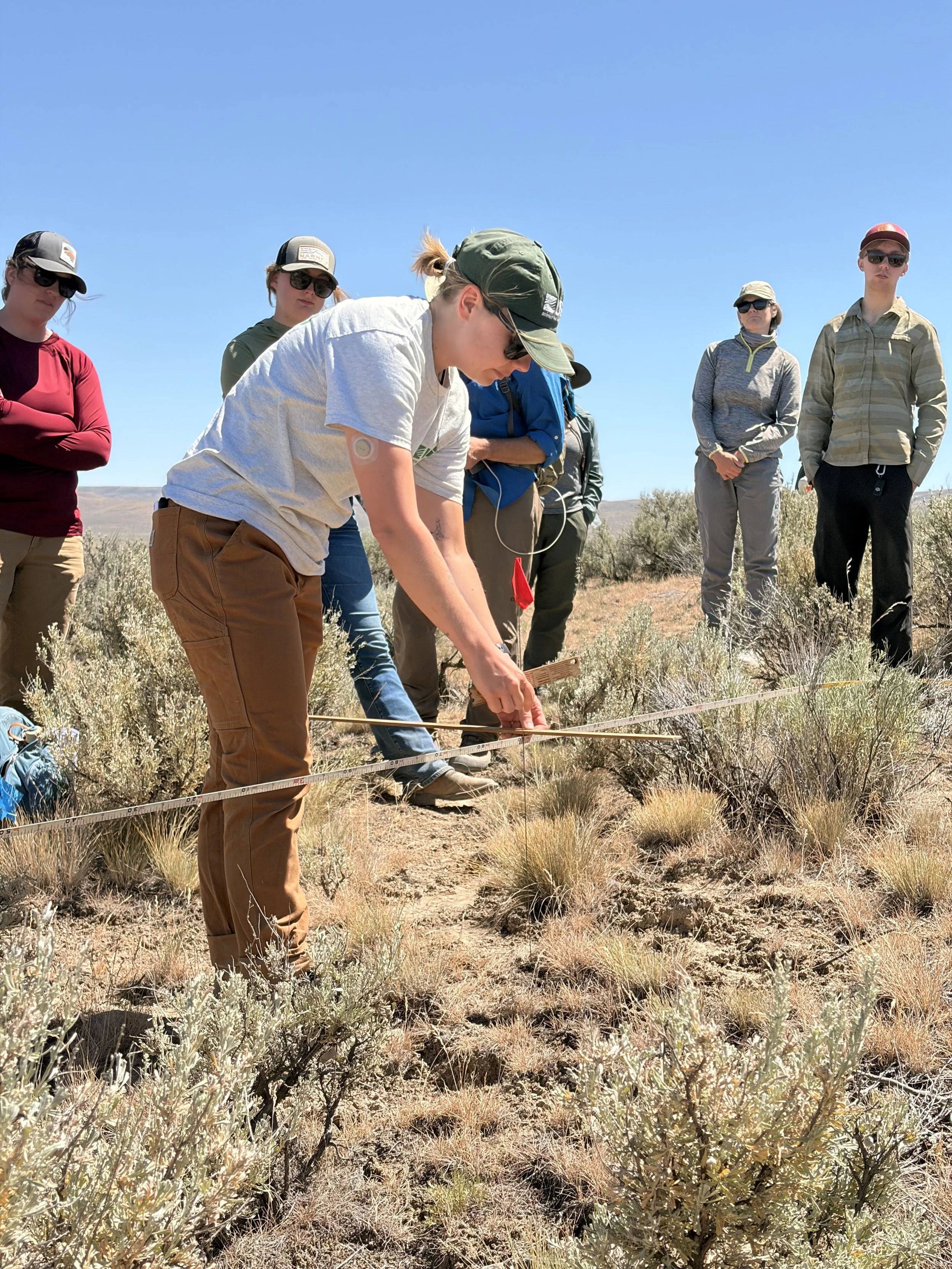
Last week, a team of staff from USGS, USFWS, and OSU Extension provided training to monitoring crews from High Desert Partnership, ODFW, and Tri-County CWMA, as well as many partners curious to know if ORMP is right for their projects. The data collected from this summer will continue to feed the dataset and build toward a better understanding of long-term outcomes from restoration investments. Results of the data collection can be viewed by project participants using an interactive dashboard that allows users to view monitoring results at multiple scales, ranging from an individual treatment to regional efforts like the SOWR project to an area encompassing all treatments monitored by ORMP in eastern Oregon. The dashboard is modeled after the three-tiered monitoring design that the ORMP advisory group identified: Tier 1 provides high-level summaries for funders and policymakers, Tier 2 offers nuanced vegetation cover details for practitioners to adaptively manage treatments, and Tier 3 enables robust scientific comparisons between plots monitored within treatments and control areas, among other analyses.
If you are interested in learning more about ORMP, check out the website or reach out to Jackie Cupples, USFWS, or Michelle Jeffries, USGS.